Friday 23rd October 1942

Abbeville Communal Cemetery Extension
(1 casualty)The town of Abbeville is on the main road from Paris to Boulogne (N1), about 80 kilometres south of Boulogne. The communal cemetery and communal cemetery extension are located on the left hand side of the road when leaving the town in a north-east direction for Drucat. CWGC direction signs will be found within the cemetery. Enter the Communal Cemetery by the left hand side main gate and follow CWGC signs within the Cemetery. The extension may be entered from the communal cemetery or from the Allée Du Souvenir Francais, where there is car parking available. GPS Co-ordinates: N50.12101, E1.83220
Alamein Memorial
(5 casualties)Alamein is a village, bypassed by the main coast road, approximately 130 kilometres west of Alexandria on the road to Mersa Matruh. The first Commission road direction sign is located just beyond the Alamein police checkpoint and all cemetery visitors should turn off from the main road onto the parallel old coast road. The cemetery lies off the road beyond the ridge, and road direction signs are in place approximately 25 metres before the low metal gates and stone wing walls which are situated centrally at the road edge at the head of the access path into the cemetery. The Cross of Sacrifice feature may be seen from the road.
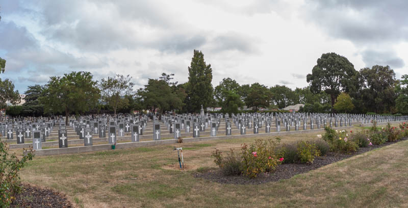
Caserta War Cemetery
(1 casualty)Take the autostrada A1 (Roma to Napoli), and leave it at the Santa Maria Cupua exit. Proceed for about 7 kilometres; after the tunnel turn right in the area called "Zona Ospedaliera". Turn right after 100 metres, then right again after another 100 metres. There is a large communal cemetery on the far side; turn right into the car park where cars should be parked within the communal cemetery grounds for security reasons. The cemetery is signposted. If travelling by train, from the station proceed down Corso Trieste and turn left at the traffic lights. Continue on for approximately 2 kilometres until you reach the roundabout. The CWGC plot will be found at the far end of the cemetery. Cemetery address: Via Generale Luigi Talamonti, 5 - 81100 Caserta (CE) Campania. GPS Co-ordinates: Latitude: 41.08862, Longitude: 14.344041.
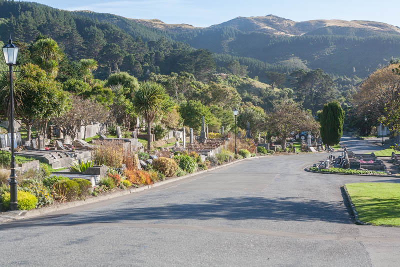
Christchurch (Bromley) Cemetery
(1 casualty)This cemetery is at the junction of Linwood Avenue and Keighleys Road, Bromley, Christchurch.
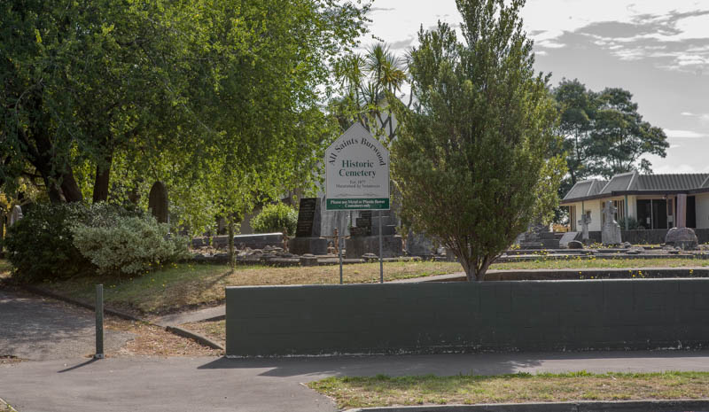
Christchurch (Burwood) Anglican Church Cemetery
(1 casualty)This cemetery is in the grounds of All Saints' Anglican Church, 305, New Brightion Road, Burwood, Christchurch. Close to Burwood School.
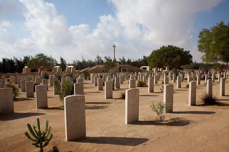
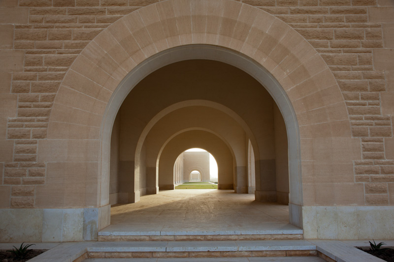
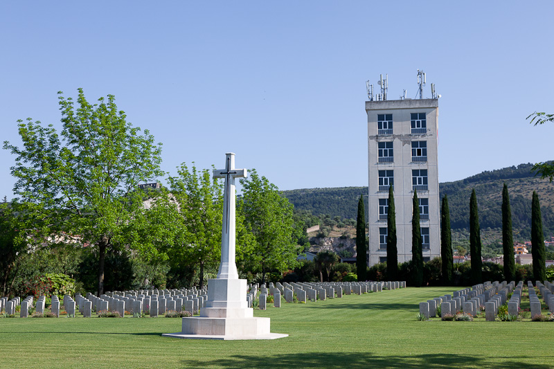
El Alamein War Cemetery
(45 casualties)Alamein is a village, bypassed by the main coast road, approximately 130 kilometres west of Alexandria on the road to Mersa Matruh. The first Commission road direction sign is located just beyond the Alamein police checkpoint and all visitors should turn off from the main road onto the parallel old coast road. The cemetery lies off the road, slightly beyond a ridge, and is indicated by road direction signs approximately 25 metres before the low metal gates and stone wing walls which are situated centrally at the road edge at the head of the access path into the cemetery. The Cross of Sacrifice feature may be seen from the road.
Nelson (Marsden Valley) Lawn Cemetery
(1 casualty)The cemetery is in Marsden Valley Road, Nelson. There is a separate area for services' interments.
Port Moresby (Bomana) War Cemetery
(1 casualty)Port Moresby (Bomana) War Cemetery lies approximately 19 kilometres north of Port Moresby on the road to Nine Mile, and is approached from the main road by a short side road called Pilgrims Way.
Runnymede Memorial
(1 casualty)This Memorial overlooks the River Thames on Cooper's Hill at Englefield Green between Windsor and Egham on the A308, 4 miles from Windsor.
Waihi Public Cemetery
(1 casualty)This cemetery is situated about 3 kilometres south of Waihi on the SH 2, approximately 250 metres south of the Waihi Beach turning. There is a separate area within the cemetery for services' interments.
Wellington (Karori) Cemetery
(1 casualty)Wellington (Karori) Cemetery will be found on Karori Road, in the north-western part of Wellington. There are separate 1914-1918 and 1939-1945 services' areas within the public cemetery. (S) at the end of the grave location denotes these. Within the cemetery is the Wellington Provincial Memorial, which takes the form of a marble archway connecting the original Services' Cemetery with the extension which was laid out later. This memorial commemorates servicepeople from the Wellington Military District who died in the 1914-1918 and 1939-1945 Wars and who have no known grave. Also in the cemetery is the Wellington (Karori) Crematorium. The names of 15 casualties from the 1939-1945 War, whose remains were cremated and the ashes scattered, are engraved on a plaque set into the Servicemen's Columbarium Wall in the services' section of the cemetery.
Westdongeradeel (Raard) Protestant Churchyard
(1 casualty)Raard is a village 2 kilometres south-west of the Dokkum-Holwerd road, 4 kilometres from Dokkum and 30 kilometres north-north-east of Leeuwarden. The churchyard surrounds the church, in the centre of the village. The two graves are near the north-western corner of the church.