Friday 12th October 1917
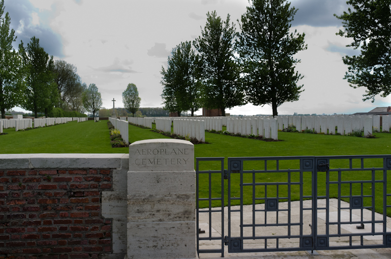
Aeroplane Cemetery
(1 casualty)Aeroplane Cemetery is located 3.5 kilometres north east of Ieper town centre on the Zonnebeekseweg (N332), a road connecting Ieper to Zonnebeke. Two roads connect Ieper town centre onto the Zonnebeekseweg; the Torhoutstraat leads from the market square onto a small roundabout. At the roundabout the first right turn is Basculestraat. At the end of Basculestraat there is a crossroads and Zonnebeekseweg is the turning to the left. The cemetery itself lies 3 kilometres along the Zonnebeekseweg on the right hand side of the road, shortly after a French cemetery.
Bedford House Cemetery
(1 casualty)Bedford House Cemetery is located 2.5 kilometres south of Ieper town centre. The cemetery lies on the Rijselseweg (N336), the road connecting Ieper to Armentieres. From Ieper town centre the Rijselsestraat runs from the market square, through the Lille Gate (Rijselpoort) and directly over the crossroads with the Ieper ring road. The road name then changes to the Rijselseweg. The cemetery itself is located 2 Km after this crossroads on the left hand side of the Rijselseweg.
Brandhoek New Military Cemetery No.3
(2 casualties)Brandhoek New Military Cemetery No 3 is located 6.5 km west of Ieper town centre, on the Zevekotestraat, a road leading from the N308 connecting Ieper to Poperinge. From Ieper town centre the Poperingseweg (N308), is reached via Elverdingsestraat then directly over two small roundabouts in the J. Capronstraat. The Poperingseweg is a continuation of the J. Capronstraat and begins after a prominent railway level crossing. 6 km along the N308, after passing the village of Vlamertinge and just beyond the church in the hamlet of Brandhoek lies the left hand turning onto the Grote Branderstraat. After crossing the N38 Westhoekweg, the first right hand turning leads onto the Zevekotestraat. The cemetery is located 300 metres along the Zevekotestraat on the left hand side of the road, beyond the N38 dual carriageway, which it is necessary to cross.
Cement House Cemetery
(1 casualty)Langemark is located north of the town of Ieper off the N313. From the Markt take the Korte Ieperstraat, at the end turn right into Boezingestraat, past the first turning on the left and the cemetery is 100 metres on the left hand side.
Divisional Cemetery
(3 casualties)Divisional Cemetery, Dickebusch Road is located 2 km west of Ieper town centre. From Ieper town centre the Poperingseweg (N308), is reached via Elverdingsestraat then straight over two small roundabouts in the J. Capronstraat. The Poperingseweg is a continuation of J. Capronstraat and begins after a prominent railway level crossing. 1km along the Poperingseweg lies the left hand turning onto Omloopstraat. The cemetery itself is located 100 metres along the Omloopstraat on the right hand side of the road.
Dochy Farm New British Cemetery
(4 casualties)Dochy Farm New British Cemetery is located 7 kilometres north-east of Ieper town centre on the Zonnebekestraat, a road leading from the Zonnebeekseweg (N332) connecting Ieper to Zonnebeke. Two roads connect Ieper town centre onto the Zonnebeekseweg. The Torhoutstraat leads from the market square onto a small roundabout. Take the first right turn which is Basculestraat. At the end of Basculestraat there is a crossroads and Zonnebeekseweg is the turning to the left. 7 kilometres along the Zonnebeekseweg, in the village of Zonnebeke, lies the left hand turning onto the Langemarkstraat (further on this street name changes to Zonnebekestraat). The cemetery lies 1.5 kilometres along this road on the left hand side.
Lijssenthoek Military Cemetery
(2 casualties)Lijssenthoek Military Cemetery is located 12 kilometres west of Ieper town centre, on the Boescheepseweg, a road leading from the N308 connecting Ieper to Poperinge. From Ieper town centre the Poperingseweg (N308) is reached via Elverdingsestraat, then over two small roundabouts in the J. Capronstraat. The Poperingseweg is a continuation of the J. Capronstraat and begins after a prominent railway level crossing. On reaching Poperinge, the N308 joins the left hand turning onto the R33, Poperinge ring road. The R33 ring continues to the left hand junction with the N38 Frans- Vlaanderenweg. 800 metres along the N38 lies the left hand turning onto Lenestraat. The next immediate right hand turning leads onto Boescheepseweg. The cemetery itself is located 2 kilometres along Boescheepseweg on the right hand side of the road.
New Irish Farm Cemetery
(5 casualties)The cemetery is located to the north-east of the town of Ieper. From the station turn left and follow along M Fochlaan to the roundabout. Turn right and at the next roundabout turn left into M Haiglaan. Follow along this road to the traffic lights and at the lights turn right in the direction of Kortrijk (A19). Follow along the expressway to the next set of lights. At these lights turn left into Pilkemseweg, then take the first right into Zwaanhofweg, a small country road. Follow this road to the crossroads and the cemetery is on your right.
Nine Elms British Cemetery
(5 casualties)Nine Elms British Cemetery is located west of Poperinge on the Helleketelweg, a road leading from the N33 Poperinge ring road. From Ieper follow the signs to Poperinge. At the traffic lights at the end of the expressway turn left onto the Poperinge ring road, the Europalaan. Follow the ring road to the roundabout and take the second exit. At the next roundabout take the second exit, follow the ring road and take the first turning on the left, the Helleketelweg. The cemetery is along here on the left.
Oosttaverne Wood Cemetery
(1 casualty)Oosttaverne Wood Cemetery is located 6 km south of Ieper town centre on the Rijselseweg N336 connecting Ieper to Lille. From Ieper town centre the Rijselsestraat runs from the market square, through the Lille Gate (Rijselpoort) and directly over the crossroads with the Ieper ring road. The road name then changes to the Rijselseweg. 3 Km along the Rijselseweg the road forks with the N365. The N336 is the left hand fork towards Lille. The cemetery is located 2 Km after this left hand fork on the right hand side of the road.
Passchendaele New British Cemetery
(43 casualties)Passchendaele (Passendale) New British Cemetery lies 10.5 kilometres north east of Ieper town centre on the S'Graventafelstraat, a road leading from St Jan to Passendale. Two roads connect Ieper town centre onto the Zonnebeekseweg; the Torhoutstraat leads from the market square onto a small roundabout. At the roundabout the first right turn is Basculestraat. At the end of Basculestraat, there is a crossroads and Zonnebeekseweg is the turning to the left. 7 kilometres along the Zonnebeekseweg, in the village of Zonnebeke, lies the left hand turning onto the Langemarkstraat (further on this street name changes to Zonnebekestraat). 2 kilometres along this road, and after passing Dochy Farm New British Cemetery, lies the right hand turning onto the 'S Graventafelstraat. 4 kilometres along the 'S Graventafelstraat, and after passing the New Zealand Memorial, lies the cemetery on the left hand side of the road.
Perth Cemetery (China Wall)
(1 casualty)Perth Cemetery (China Wall) is located 3 km east of Ieper town centre, on the Maaldestedestraat, a road leading from the Meenseweg (N8), connecting Ieper to Menen. From Ieper town centre the Meenseweg is located via Torhoutstraat and right onto Basculestraat. Basculestraat ends at a main cross roads, directly over which begins the Meenseweg. 1.7 km along the Meenseweg at a major roundabout lies the right hand turning onto the Maaldestedestraat. The cemetery itself is located 1 km along the Maaldestedestraat on the left hand side of the road.
Poelcapelle British Cemetery
(35 casualties)Poelcapelle British Cemetery is located 10 kilometres north east of Ieper town centre on the Brugseweg (N313), a road connecting Ieper to Brugge. Two streets connect Ieper town centre onto the Brugseweg; Torhoutstraat leads from the market square onto the Kalfvaartstraat. At the end of Kalfvaartstraat is a large junction on which Brugseweg is the first right hand turning. The cemetery itself lies 10 kilometres along the Brugseweg on the right hand side of the road after passing through the village of Poelkapelle.
St. Sever Cemetery Extension, Rouen
(1 casualty)St Sever Cemetery and St. Sever Cemetery Extension are located within a large communal cemetery situated on the eastern edge of the southern Rouen suburbs of Le Grand Quevilly and Le Petit Quevilly. If approaching Rouen from the north, head for the centre of town and cross over the river Seine, following signs for Caen. Follow this route until you get to the 'Rond Point des Bruyeres' roundabout (next to the football stadium), then take the first exit into the Boulevard Stanislas Girardin. The cemetery is 150 metres down this road on the left. If approaching Rouen from the south, follow the N138 (Avenue des Canadiens) towards the centre of town. At the 'Rond Point des Bruyeres' roundabout (next to the football stadium), take the fourth exit into the Boulevard Stanislas Girardin. The cemetery is 150 metres down this road on the left. If arriving on foot, take the metro to St Sever Metro Station, then follow the Avenue de Caen until you get to the Avenue de la Liberation, then take this road and follow this, which will become the Boulevard du 11 Novembre. At the end of this road is the 'Rond Point des Bruyeres' roundabout. Take the first exit from this into the Boulevard Stanislas Girardin. The cemetery is 150 metres down this road on the left.
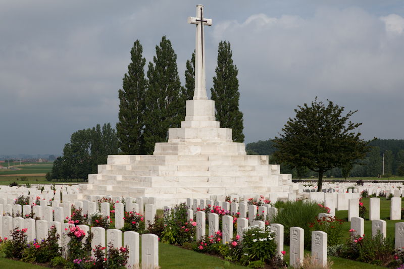
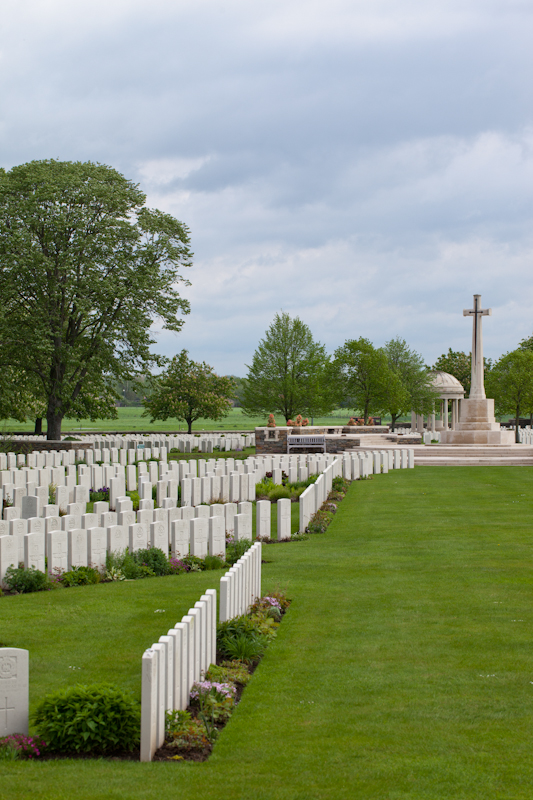
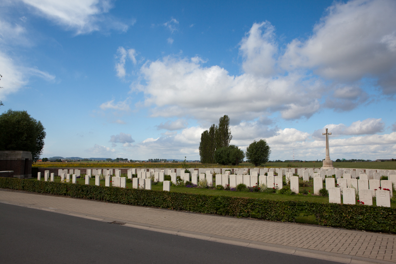
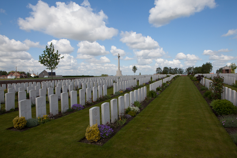
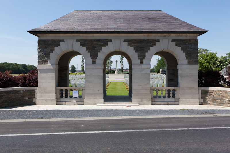
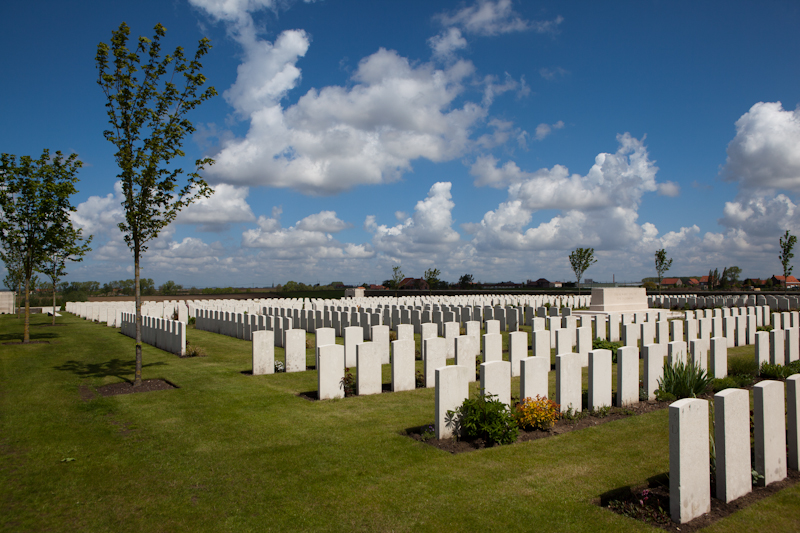
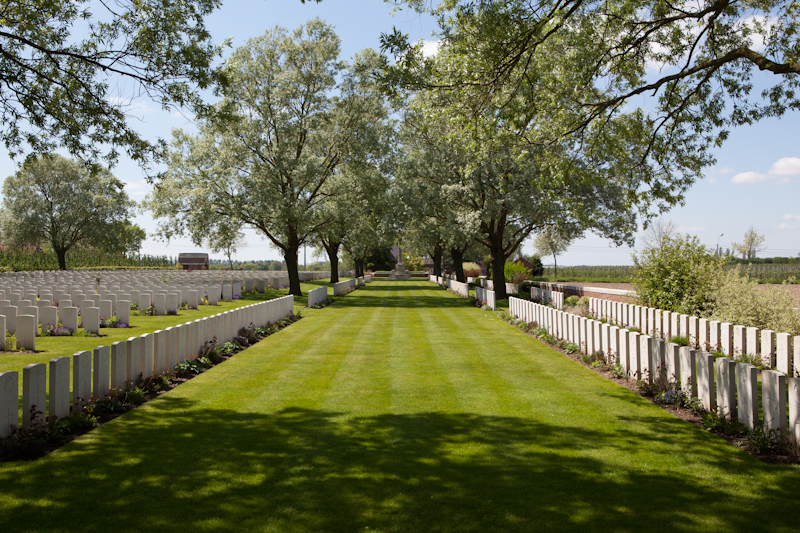
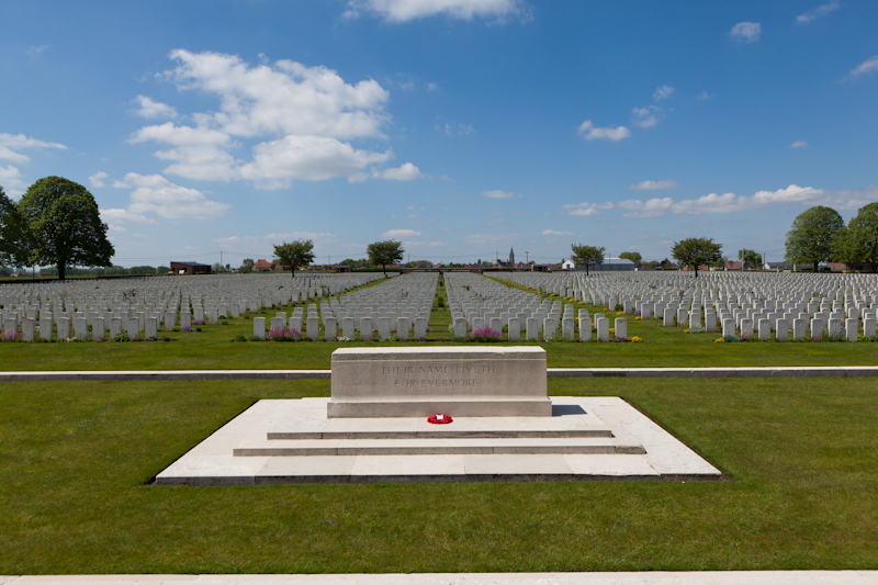
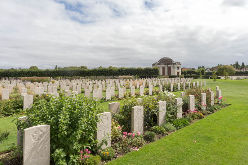
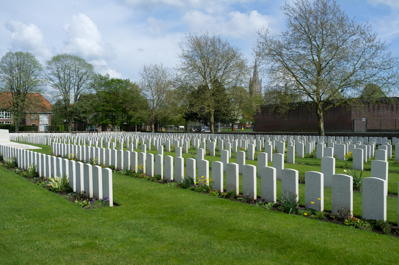
Tyne Cot Cemetery
(71 casualties)Tyne Cot Cemetery is located 9 kilometres north east of Ieper town centre, on the Tynecotstraat, a road leading from the Zonnebeekseweg (N332).
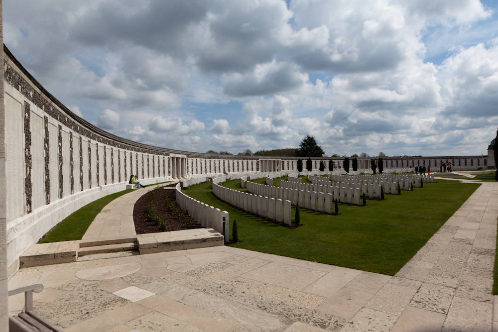
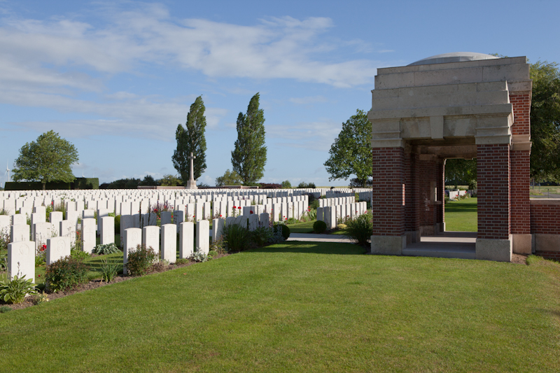
Tyne Cot Memorial
(670 casualties)The Tyne Cot Memorial to the Missing forms the north-eastern boundary of Tyne Cot Cemetery, which is located 9 kilometres north east of Ieper town centre, on the Tynecotstraat, a road leading from the Zonnebeekseweg (N332). The names of those from United Kingdom units are inscribed on Panels arranged by Regiment under their respective Ranks. The names of those from New Zealand units are inscribed on panels within the New Zealand Memorial Apse located at the centre of the Memorial.
White House Cemetery
(3 casualties)The Cemetery is located north-east of Ieper on the Brugseweg (N313) in the direction of Roeselare/Brugge. From the Grote Markt in Ieper take the road called Korte Torhoutstraat and at the end turn left into Lange Torhoutstraat, follow this road over the roundabout into Kalfvart and continue to the traffic lights. At the traffic lights turn right into Brugseweg and the cemetery is along here on the left before the village of St Jan.
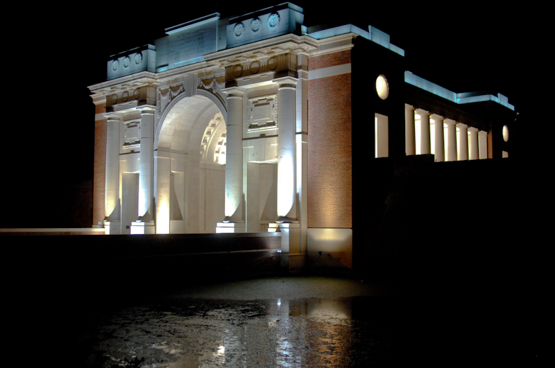
Ypres (Menin Gate) Memorial
(1 casualty)Ypres (now Ieper) is a town in the Province of West Flanders. The Memorial is situated at the eastern side of the town on the road to Menin (Menen) and Courtrai (Kortrijk). Each night at 8 pm the traffic is stopped at the Menin Gate while members of the local Fire Brigade sound the Last Post in the roadway under the Memorial's arches.
Ypres Reservoir Cemetery
(1 casualty)The cemetery is located to the North West of Ieper. From the station turn left and drive along M.Fochlaan to the roundabout, turn right and go to the next roundabout. Here turn left into M.Haiglaan and continue for 300 metres and then turn right into M.Plumerlaan. The cemetery is on the right hand side, approximately 200 metres along the road.